Nested within this exceptional field season has been the completion of my master’s thesis fieldwork, currently titled 130 years of change: an analysis of vegetation patterns and fluvial geomorphology of the Bow and Elbow watersheds.
It was the compelling accounts of last year’s floods (June 2013), when up to 270mm of rain fell within three days, leading to severe debris flows and floods, that led me to a deeper exploration of the processes at play within the Bow and Elbow watersheds. More broadly, I was keen to undertake a master’s project that would have practical application, linking research with policy. One of the biggest challenges of our time is, after all, the effective conservation and management of our freshwater.
Before I jump into my research questions, I thought I would share a particularly compelling passage I recently read in Robert William Sandford’s book, “Cold Matters The State and Fate of Canada’s Fresh Water”:
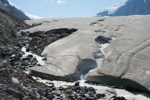
If we include all the water frozen in permanent snow, glaciers and permafrost, Canada possesses almost 20 per cent of all the fresh water on earth. In some ways, however, this is a highly deceiving statistic. The fact is that because this water is trapped as ice or is found in deep lakes left over from earlier, colder periods in our planet’s history, it becomes available to us only once: when it melts. Water produced by the natural hydrological cycle, on the other hand, renews itself annually. When we subtract that water from out total supply we discover that Canada actually possesses only about6.5 per cent of the water that circulates through the global hydrological cycle each year (…) the water stored in snow and ice in Canada is disappearing far faster than we expected. The amount of water made available to us each year through the hydrological cycle is also changing, as is the ratio of how much precipitation falls as rain instead of snow. While one might not think this matters, it does (…) (Sandford 2012:2).
In the context of these rapidly changing conditions, I pose 2 distinct questions:
- What patterns of vegetation change can be detected across the Bow and Elbow watersheds using computer-assisted classification of historical and repeat oblique photographs over the past 130 years?
- Are there changes in the form of the Bow and Elbow rivers that suggest an evolution in fluvial geomorphologic processes (i.e. can we detect planform changes on the Bow and Elbow Rivers between 1880 and 2014 using oblique and air photographs)?
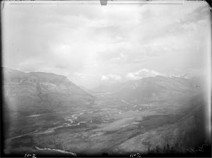
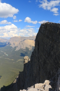
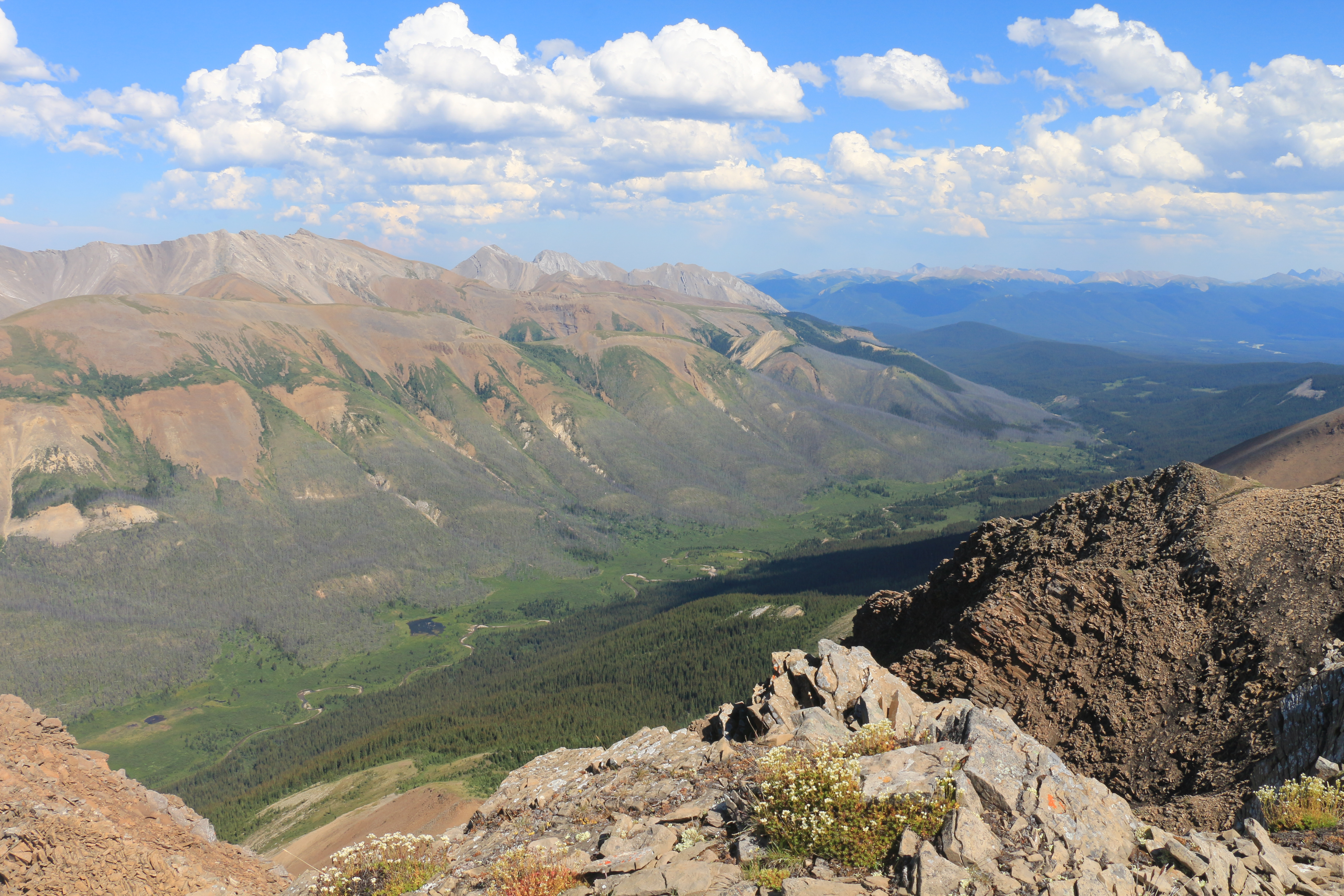
The view from Mt. Lawrence Grassi in 1888
I will be using a sample of this summer’s work, as well as that of past MLP field seasons, to address the first question, looking at vegetation change. This will be the first graduate project to use Frederic Jean (post-doc in computer science at UVic)’s recently developed software named P.O.T.A.T.O.E.S. (polygon optimization tool and texture outlining expert system). This software allows me to map and calculate the percent cover change of different habitat types throughout the landscape – exciting!
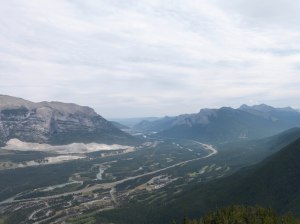
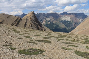
The same view, now including the town of Canmore, from 2008
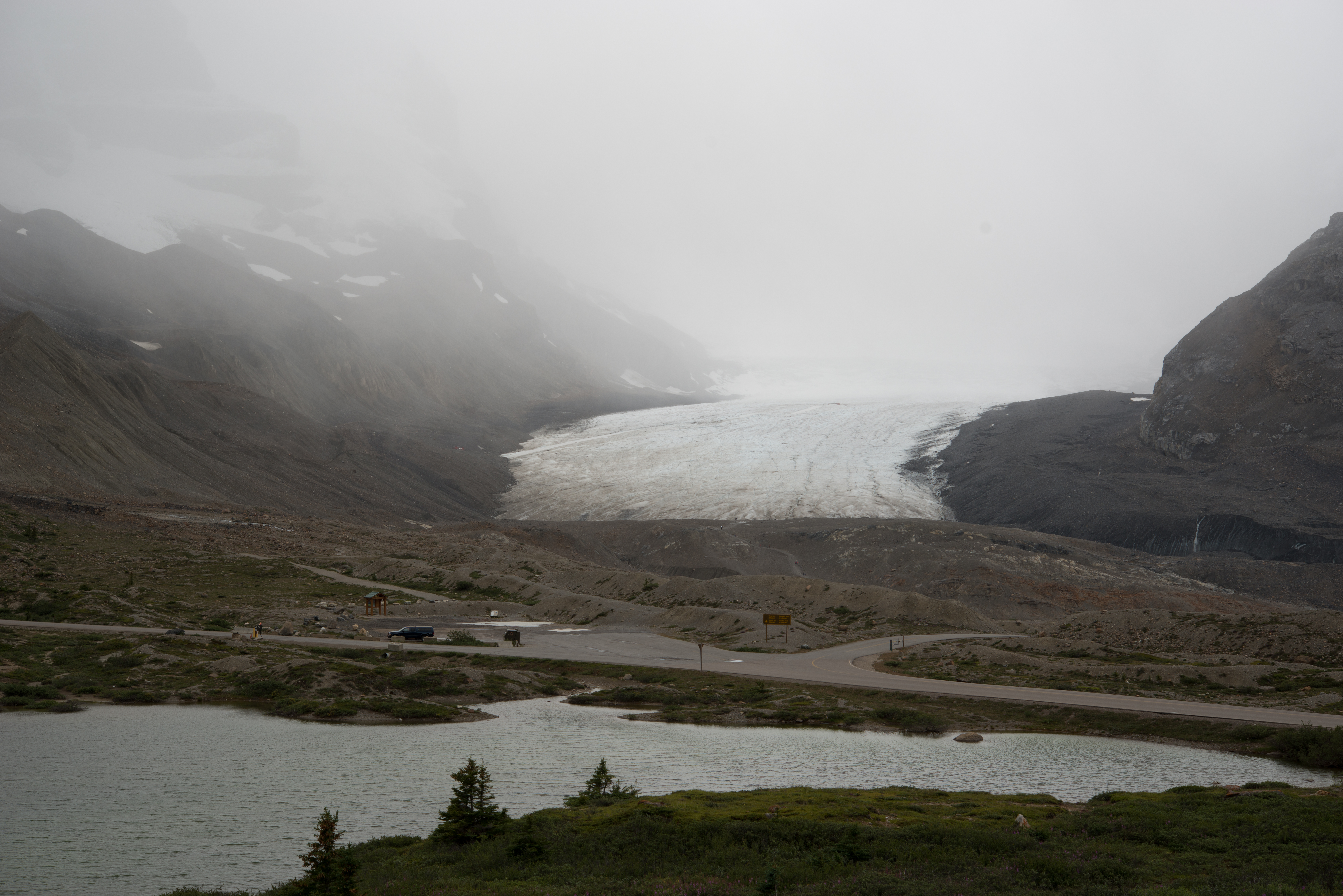
The geomorphology inquiry, which will assess channel changes in both the Bow and Elbow, will be based on aerial images, LIDAR data as well as a sub-set of oblique images. There are roughly 20 stations that were completed this summer specifically for my research, as they are third views (meaning the historical photographs had already been repeated in 2008 or 2009, but we returned a third time). The logic behind this is to have a pre and post 2013 flood dataset. I will first digitize channel changes using the aerial photographs and LIDAR data, then explore those changes in greater detail using the oblique photographs. My hope is that the act of combining these different sources, representing a significant temporal period (100+years) will yield interesting results on the evolution of these rivers over the past century. Naturally I will link my findings, in due time, with their associated implications for watershed management.
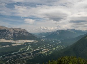
And again from 2014
I am extremely grateful to have had the opportunity to nest my research within the broader MLP field season, and to have such a great team (Vladka Lackova-Gat, Kristen Walsh, Nicole Goodman, Rick Arthur, Rob Watt, Mary Sanseverino and Michael Whitney) to support me in gathering the photographs from my stations of interest and sharing their thoughts, advice and wisdom along the way. I would also like to take the opportunity to thank the following individuals who have been (and continue to be) invaluable mentors: Fred Roots, Frank Duerden, and Matthias Jakob. I was fortunate enough to meet with the flooding expert group (engineers) for the town of Canmore, and extend my appreciation to them for their time, feedback and willingness to share historical photographs/data. The same gratitude goes to BGC Engineering in Vancouver, whose team I have and will be working with over the coming months on the digitization of channel changes.
I would like to extend a special thanks to the Mountain Legacy Project for the opportunity to embark on this field season and utilize the photographs and necessary softwares for my research, as well as Alberta ESRD for their generous direct and in-kind support for the Mountain Legacy Project, which made this field season possible in the first place.
Finally, I extend my gratitude to Eric Higgs, my supervisor, and Brian Starzomski, for the continuous support since the start of the program. I look forward to seeing how the results unfold, and extend an invitation to all readers to offer any thoughts/ideas/feedback as a comment on this blog post.
— Tanya Taggart-Hodge


![[Left to right] Kristen Walsh, Mandy Arnaud and Nicole Goodman lining up historic photos and preparing field notes](https://mountainlegacy.files.wordpress.com/2014/07/dscf0659.jpg)


![[Left to right] Rick Arthur, Brent Davis (alpine instructor), Nicole Goodman, Tanya Taggart-Hodge and Vladka Lackova-Gat](https://mountainlegacy.files.wordpress.com/2014/07/dscf0746.jpg)
![[Rick Arthur, Vladka Lackova-Gat] The Rocky Mountains are notoriously “easy crumbling”. We will likely be yelling “rock” lot this summer, when throwing loose pieces over the ridge.](https://mountainlegacy.files.wordpress.com/2014/07/img_2463.jpg)

![[From left to right] Kristen Walsh, Mary Sanseverino, Mandy Annand (former MLP member visiting for the day), Vladka Lackova, and Rick Arthur).](https://mountainlegacy.files.wordpress.com/2014/07/img_2502.jpg)


![[Left to Right] Tanya Taggart-Hodge and Vladka Lackova flying with the door off; Vladka as the “Station whisperer” and Tanya as the Photographer](https://mountainlegacy.files.wordpress.com/2014/07/tanya-vladka-doing-a-hover-over-mt-elbow.jpg)
![[Left to right] Mary Sanseverino and Vladka Lackova on the Summit of Mt.Chester, thunder in the distance](https://mountainlegacy.files.wordpress.com/2014/07/mary-vladka-on-top-of-mt-chester.jpg)
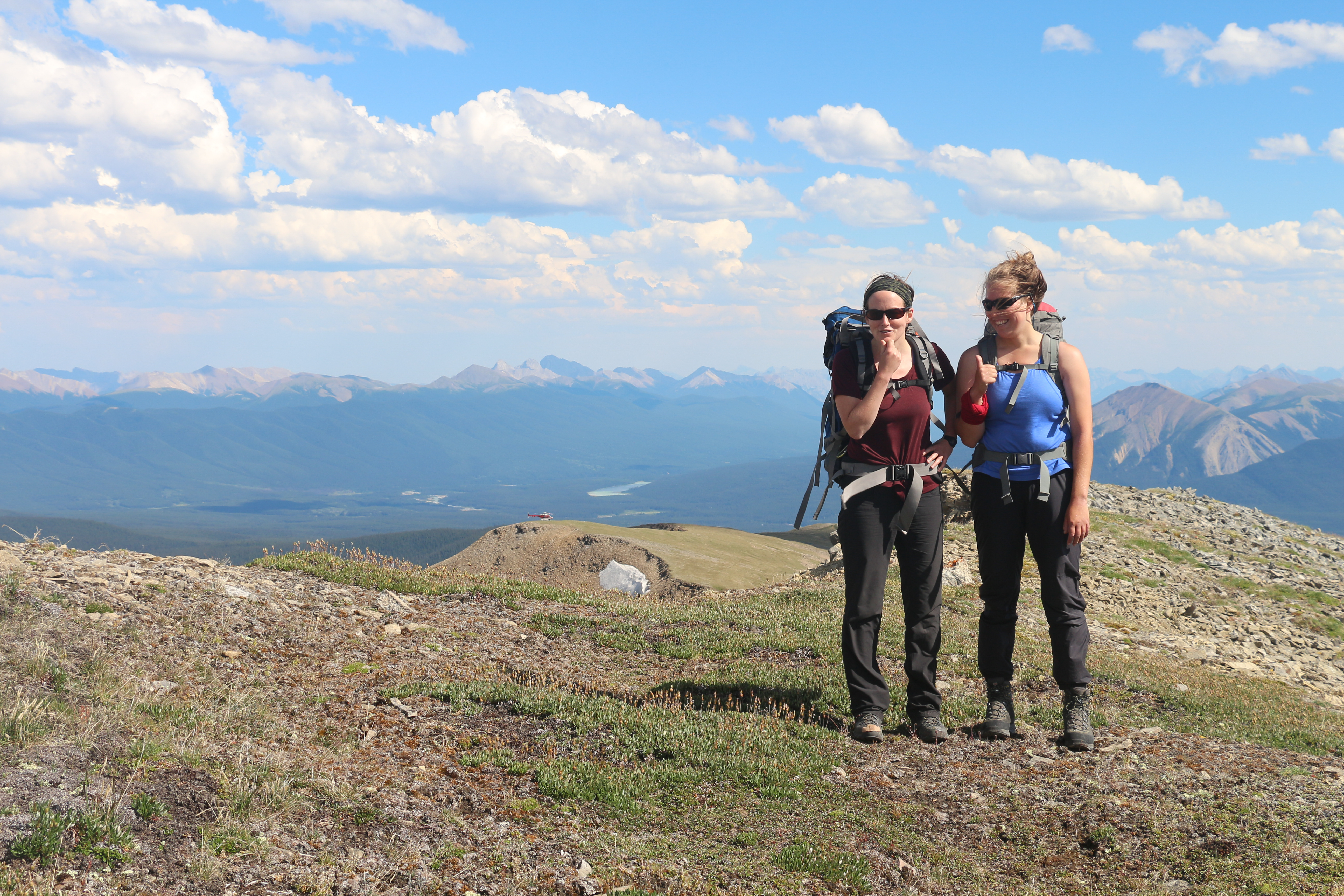
![[Left to Right] Nicole Goodman and Kristen Walsh on Mt.Indefatigable](https://mountainlegacy.files.wordpress.com/2014/07/nicole-kristen-on-mt-indefatigable.jpg)


 ... tired, but fulfilled with good work done (8 stations) and the beauty of these mountains touched by soft evening light.")


