After a beautiful week in Willmore and our last picturesque flight there over glaciers (with Mt. Robson looming in the background) we were ready to move once again. This time we headed to our third location of this summer–Shunda Fire Base in Clearwater area, between Nordegg and Rocky Mountain House on Highway 11.
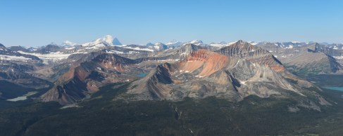
Willmore with Mt. Robson in the background.
Scenic flight over the glaciers.
The last time driving on the Icefield highway we had a rainy day, so we decided to take the same route down south to take advantage of the beautiful sunny day. We made several scenic stops on the way, enjoying canyons, rivers, and waterfalls, and especially the Colombia Icefields and dominant Athabasca glacier. We even got to walk on the glacier!
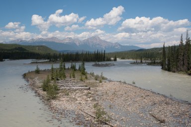
Athabasca river close to Jasper.
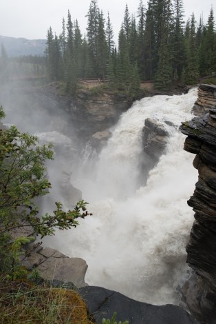
Mighty Athabasca Falls.

Stairs to Athabasca canyon.
Black bear just across the highway.

Jasper Lake.

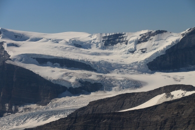
Colombia Icefield with impressive Athabasca glacier.

Impressive and sadly disappearing Athabasca glacier.
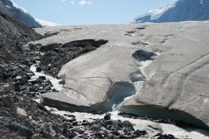
Melting glaciers.
After passing Saskatchewan crossing and heading east, we drove through a burnt area followed by a smoky forest that was still ablaze. It was a great experience for us to finally see fire fighters and helicopters with bambi buckets in action.
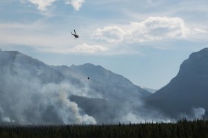
Fire 34 in Siffleur Wilderness Area.

Prescribed burn from 2009.
Shunda welcomed us big time with a huge thunderstorm, hail and a lovely double rainbow. The weather here is unpredictable (to say the least!) and we can never tell from the morning what kind of storms the afternoon and evening will bring.
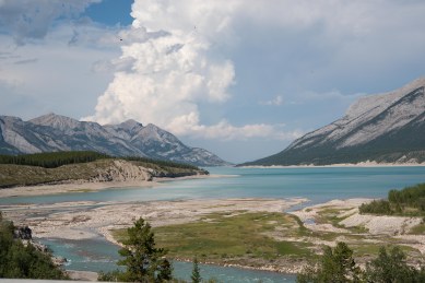
Abraham Lake with a thunder cloud in the background.

Thunderstorm passing through.

Shunda welcomed us with double rainbow.
Getting ready for the storm at our station while waiting for the helicopter to pick us up.

Hail in Nordegg even caused some damage.
On our first weekend here we had a visitor–Chris Gat, who has been involved with MLP for the last 5 years. Chris is the developer of our project database and our interactive website (www.explore.mountainlegacy.ca). He also spent the summer of 2009 on the MLP field crew, so it was great for him to get back into the field with us for a day! He joined us on one of the more scenic stations over Pinto Lake, with glaciers around and a sheer drop below us.
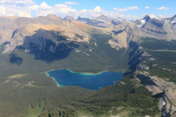
Pinto Lake at White Goat Wilderness area on the border with Banff National Park.
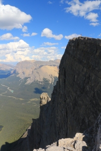
Chris enjoying an amazing view from our station. The drop was pretty scary.
After an excellent introduction day to this area we finally took our first weekend off and (what a surprise) we decided to go back to the mountains for an overnight hike and some much needed time off.
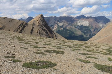
White Goat Wilderness Area.
We were lucky enough to have helicopter support every day last week and have visited many beautiful stations with glacier views. Seeing how much all of these glaciers have shrunk since the 1928 survey is sobering, and is reminding us how important this work is. This photos are taken only 86 years apart.


 ... tired, but fulfilled with good work done (8 stations) and the beauty of these mountains touched by soft evening light.")


Amazing photos guys! It helps me feel like I am there experiencing everything with you.
Love you Kris!
mom
xo
By: Sue on August 16, 2014
at 10:02
Reblogged this on BC Out of Doors and commented:
The Mountain Legacy Project – working in the eastern slopes of the Rockies. Catch them on Facebook too: https://www.facebook.com/mountainlegacyproject
By: msanseve on August 19, 2014
at 09:16